search

Search

Hikes and Waterfalls Near Asheville, NC

Waterfall hikes and summit trails near Asheville, from Graveyard Fields to DuPont Forest, with distances, parking tips and trail status.

card image
Plenty of the waterfalls and views around Asheville are an hour or less from downtown and cost nothing to visit. This guide covers the waterfall hikes and summit trails we keep going back to, from short walks on the Blue Ridge Parkway to the waterfalls of DuPont State Recreational Forest and Pisgah National Forest.

Two years after Hurricane Helene, most trails are back open, but some stairs, platforms and side trails are still closed. We link each official status page below, so check it before you drive. Parking at popular trailheads fills early on weekends and in October, so start early or go on a weekday. Updated October 2026.

Blue Ridge Parkway, south of Asheville
The Blue Ridge Parkway road status page is the first thing to check. Sections close for ice and snow in winter. The park service says hikers should use caution on Parkway trails after Hurricane Helene, because unseen hazards may be present.

  • Graveyard Fields, Graveyard Fields Overlook, Parkway milepost 418.8. A grassy valley with two waterfalls on Yellowstone Prong. Second Falls is 0.3 miles from the trailhead, down a 60-step wooden stairway. Upper Falls is 1.6 miles in, on a rougher, steeper spur, so seeing both falls is about 3.2 miles round trip. Blueberries are thick in the fall. Forest Service trail page
  • Black Balsam Knob, end of Black Balsam Road (FS 816) at milepost 420. The Art Loeb Spur is a short, steep 0.6 miles up a grassy bald with long views. Stay on the switchbacks, because the bald is fragile.
  • Sam Knob Trail, from the same Black Balsam area. The Forest Service rates this 1.07-mile trail easy, and it's foot traffic only. Forest Service trail page
  • Devil's Courthouse, milepost 422.4. A 0.4-mile climb, rated moderate to strenuous, to a rocky summit with a panoramic view. Bring binoculars.

Close to town
  • Bent Creek Experimental Forest, Lake Powhatan area in Pisgah National Forest. Nearly 6,000 acres of research forest at the edge of Asheville. The Explorer Loop is 3 miles round trip with one steep climb. Stay on marked trails, because research plots are off limits. Forest Service research page
  • Craggy Pinnacle and Craggy Gardens, Parkway milepost 364, north of town. The Craggy Pinnacle trail is about 0.7 miles to a 360-degree summit view. The Craggy Gardens Trail starts with a 0.3-mile climb to a trail shelter. The park service says some Craggy trails are closed or only partly open after storm damage. Park service trail page

Brevard and Pisgah National Forest
  • Looking Glass Falls, US 276, about 6 miles north of the Pisgah Ranger Station. You can see this one from the roadside, and there's no fee. Swimming is allowed, but there's no lifeguard. Parking is limited, so don't park in the road. Forest Service page
  • Sliding Rock, 7851 Pisgah Highway, north of Brevard. A 60-foot natural water slide into a pool 8 to 10 feet deep. Lifeguards are on duty Memorial Day through Labor Day, and you have to be able to swim to slide. There's a $6 daily fee per person, and kids 5 and under are free. The parking lot fills on summer weekends and closes until spaces open. Forest Service page
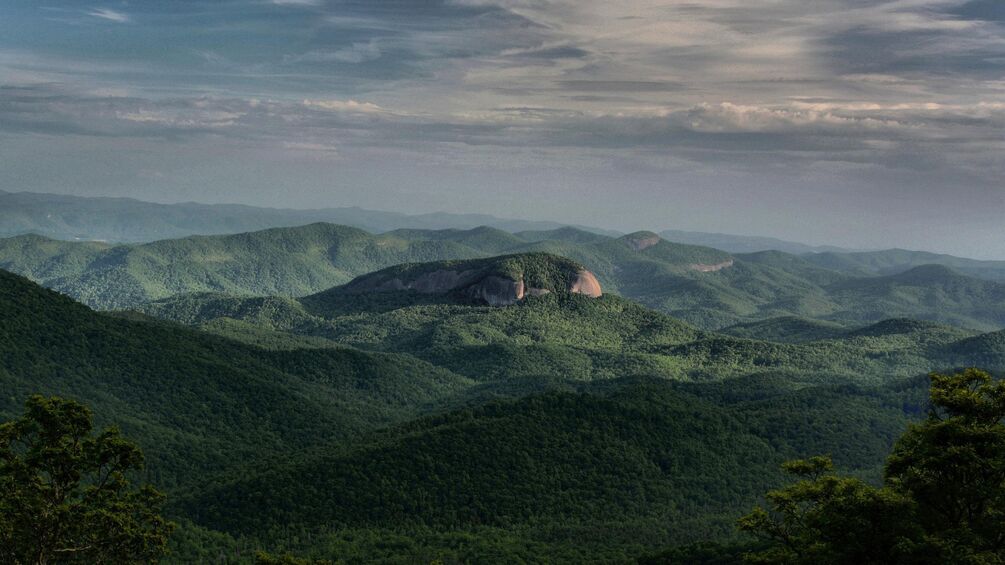
  • Looking Glass Rock, paved trailhead lot off US 276 in the Pisgah Ranger District. A 3.1-mile climb that barely lets up, and the last mile is the steepest. It gets very busy in summer and fall color season, so bring plenty of water and a picnic for the top. Forest Service trail page

DuPont State Recreational Forest
DuPont has no entrance fee, but donations help keep the trails up. Dogs are welcome on a leash. There are no trash cans, so pack everything out. Wading or climbing above any waterfall is prohibited. Several older trails are closed for good, and the Triple Falls stairs are closed after Helene damage. Check the DuPont Forest alerts page before you go.

  • High Falls Loop, High Falls Access Area. An easy 0.5-mile walk from the Visitor Center to High Falls. Grab a paper map at the Visitor Center.
  • Triple Falls, from the Hooker Falls or High Falls Access Areas. View the three drops from the overlook, since the stairs to the base are closed. The trail up from Hooker Falls has a steep section.
  • Hooker Falls, Hooker Falls Access Area. A short walk from the lot to a wide falls and pool that's a popular summer swimming hole. Non-swimmers should be very careful in the moving water.
  • Bridal Veil Falls, reached from the High Falls, Fawn Lake or Corn Mill Shoals Access Areas. A longer walk to a broad, sloping falls.
  • Wintergreen Falls, Guion Farm Access Area. An easy 1.25-mile hike to one of the smallest falls in the forest, on the Hendersonville side.

Day trips
  • Chimney Rock at Chimney Rock State Park, Chimney Rock, about 25 miles southeast of Asheville. The Hickory Nut Falls Trail is 0.7 miles one way, rated moderate. Trails are partly open: Weed Patch Mountain, Tunnel and Riverwalk are closed. Admission is charged per person, and reservations are recommended on October weekends. For a free option nearby, the Rumbling Bald access has a 1.5-mile loop. NC State Parks page
  • Catawba Falls, Old Fort, Pisgah National Forest. The trail to the 205-foot lower falls is easy. The quarter mile up to the 80-foot upper falls is steep enough that the Forest Service compares it to climbing a 30-story building. Come back on the Catawba Falls Ridge Trail to make a 3.5-mile loop. The upper viewing platform reopened in September 2026 after Helene repairs (Smokies Live), so check the Forest Service page for the Wildflower Trail. Forest Service page
  • Mount Mitchell State Park, off the Parkway north of Asheville. The park has short loops like the 0.7-mile Balsam Nature Loop and longer climbs like the 2-mile Old Mitchell Trail. The park says to reach it from the Asheville side of the Parkway, and there's no gas between Asheville and the park. NC State Parks trail page
  • Max Patch, near Hot Springs on the Appalachian Trail. A 1.5-mile loop climbs a 4,629-foot grassy bald with 360-degree views. The last miles are narrow gravel road, parking is small, and there are no restrooms at the trailhead. Camping and fires are banned through June 2029. Forest Service page

Hikes and waterfalls FAQ
How long is the Graveyard Fields loop?
About 3.2 miles round trip if you see both waterfalls, according to the Forest Service. Second Falls is just 0.3 miles from the trailhead, and Upper Falls is 1.6 miles in. Coming back on the southern half of the loop makes it a little shorter.

Which waterfall hikes near Asheville are free?
Most of them. DuPont State Recreational Forest has no entrance fee (Friends of DuPont Forest), and the Forest Service lists no fee at Looking Glass Falls (Forest Service). Graveyard Fields and the other Parkway trails are free too. Chimney Rock and Sliding Rock are the main ones that charge admission.

Can you swim at waterfalls near Asheville?
At some. Hooker Falls in DuPont is a popular summer swimming hole (Friends of DuPont Forest), and swimming is allowed at Looking Glass Falls with no lifeguard on duty (Forest Service). Never climb or wade above a waterfall. The rocks are slick, and DuPont prohibits it.

Are trails near Asheville open after Hurricane Helene?
Mostly. In September 2026, the Forest Service said access has been restored to nearly all recreation sites and trails in the Pisgah and Nantahala National Forests (Forest Service). Some stairs, platforms and side trails are still closed, so check the official page for each hike before you go.

Chasing leaves? Our guide to fall colors in Asheville covers Parkway overlooks and fall hikes near town. Know a trail we missed? Let us know. Browse more on our Hikes & Waterfalls page, or head back to Dig Deeper for more ways to explore Asheville.

Photos: National Park Service / A. Armstrong.